Where to Hike Near Vancouver, Washington: Forest Walks, Waterfalls, and Gorge Views
Choose a close-to-town forest walk, a waterfall outing, or a Columbia Gorge climb based on how much time you have and the kind of day you want on the trail.
Research-based guide · Official information checked August 27, 2026 · Based on official sources rather than firsthand trail testing
TRAIL UPDATE — In August 2026, construction has closed several trails in the northeast corner of Lacamas Regional Park. Beacon Rock State Park requires a Discover Pass and posts alerts for individual trails. Check each park’s official page again on publication day.
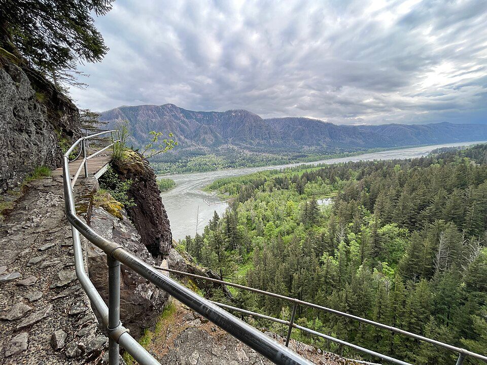
Even with railings and built stairs, Beacon Rock Trail can feel exposed high above the Columbia River. Photo: Steven Pavlov · CC BY-SA 4.0 · source · license
How to choose the right hike near Vancouver
There is no single ranking that works for every hike near Vancouver. A shaded walk at Whipple Creek, a waterfall outing at Moulton Falls, and a climb in Beacon Rock State Park involve very different drive times, trail conditions, and physical effort. Choose the experience that fits your day, then check current conditions for that park.
For a short outing close to town, Whipple Creek or Lacamas Regional Park usually makes more sense than driving into the Gorge. Moulton Falls offers river and waterfall scenery without a major climb. Beacon Rock State Park is the better choice for sweeping Gorge views, but the steeper trails require more planning. Check parking requirements and park alerts before you go.
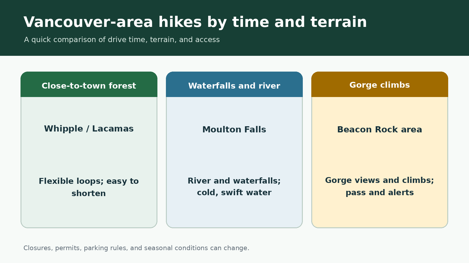
Quick trail comparison created for this guide; not an official map or GPS route.
At a glance
|
Area |
Best fit |
What to expect |
Access note |
|
Whipple Creek |
A forest walk close to town |
4.3-mile trail network; natural surfaces can be muddy |
County park; check wet-weather restrictions |
|
Lacamas Regional Park |
Flexible loops near Camas |
9.5 miles of gravel and dirt trails |
Construction affects part of the network in 2026 |
|
Moulton Falls |
Waterfall and river scenery |
2.5-mile link to Lucia Falls; longer Bells Mountain option |
No lifeguard; swift, cold water |
|
Beacon Rock State Park |
Gorge views and steeper trails |
Beacon Rock’s 52 switchbacks; longer routes on Hamilton Mountain and Hardy Ridge |
Discover Pass; trail-specific alerts |
Distances can vary depending on the route you choose. Check the managing agency’s current trail page before you go.
Short forest walks near Vancouver
Whipple Creek Regional Park is a 300-acre forest near Ridgefield with 4.3 miles of trails. Its interconnected loops make it easy to shorten or extend your walk instead of following one fixed route. The natural-surface trails can become muddy, and seasonal wet-weather rules may limit bicycle and horse use even when the trails remain open to hikers.
Lacamas Regional Park offers more route variety, including connections toward Round Lake and the Lacamas Heritage Trail. Clark County lists 9.5 miles of gravel and dirt trails, a restroom, and a small parking area. In 2026, bridge work has closed several trails in the park’s northeast construction zone. Follow posted detours rather than relying on an older app map.
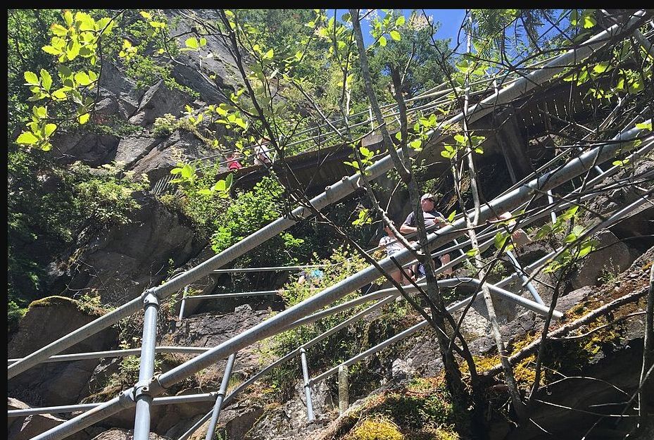
Tight switchbacks and railings make Beacon Rock Trail feel very different from a level park walk. Photo: King of Hearts · CC BY-SA 4.0 · source · license
Waterfall walks north of Vancouver
Moulton Falls Regional Park combines two waterfalls, a high arch bridge, and a forested river corridor. The county’s 2.5-mile trail to Lucia Falls is the most straightforward walking option. Bells Mountain Trail begins in the same trail system, but it is a much longer backcountry route, not a casual add-on to a waterfall walk.
The river is part of the appeal and also the main hazard. Clark County warns that there are no lifeguards and that cold water, changing currents, drop-offs, and underwater debris can quickly turn a casual swim into an emergency. Stay at the designated viewpoints, never jump from the bridge, and do not assume calm-looking water is safe.
Beacon Rock: from an easy paved loop to exposed Gorge climbs
Beacon Rock Trail climbs the face of the rock on 52 switchbacks. It is short compared with Hamilton Mountain. The railings and maintained path provide some reassurance, but the trail still feels exposed in places. Hikers who are uneasy with heights may find parts of the route uncomfortable. Doetsch Walking Path is the gentler alternative: a paved, flat 1.2-mile loop with interpretive panels.
Hamilton Mountain and Hardy Ridge are in the same park, but both are much more demanding than Beacon Rock Trail or Doetsch Walking Path. Allow more time and be prepared for additional climbing and changing weather. See the dedicated Hamilton Mountain guide for route details, and check the park alerts before heading to Hardy Ridge in snow or strong wind.
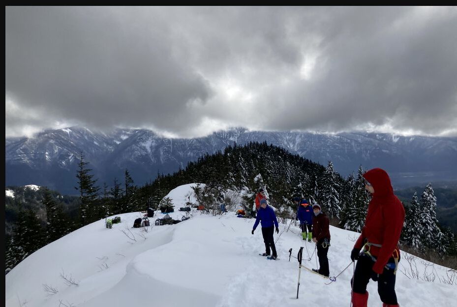
Snow on Hardy Ridge can turn an ordinary hike into a winter outing that calls for different gear and more time. Photo: Mattsjc · CC BY-SA 4.0 · source · license
Parking, passes, and the best time to arrive
Clark County parks and Washington State Parks use different fee systems. A Discover Pass is required at Beacon Rock State Park. As of August 27, 2026, the park lists a $10 one-day pass and a $45 annual pass. Check each Clark County park page separately for parking updates, construction, and hours.
Arriving early helps at the smaller lots, but it does not make roadside parking legal. If a lot is full, switch to another trail rather than blocking a road or gate. In late summer, also check heat, smoke, fire restrictions, and water availability. The open, exposed trails in the Gorge can feel much hotter and windier than the shaded county parks.
Which hike is the best fit?
If you have only an hour or two, choose Whipple Creek or an open section of Lacamas Regional Park. For an easy-to-moderate waterfall walk, follow the Moulton Falls–Lucia Falls corridor. Beacon Rock Trail is a good fit for a short climb with sweeping views and some exposed sections. For a longer Gorge hike, consider Hamilton Mountain or Cape Horn after checking seasonal restrictions.
Related hiking guides
Hamilton Mountain Trail
Cape Horn Trail
Best Hikes Near Portland
Official sources
Last checked August 27, 2026. Conditions can change, so review current park alerts before your trip.
Washington State Parks — Beacon Rock State Park
Clark County — Lacamas Regional Park
Clark County — Moulton Falls Regional Park
Clark County — Whipple Creek Regional Park
Photo and graphic credits
2023-05-06, Beacon Rock Trail, 028 — Steven Pavlov; CC BY-SA 4.0. Source · License
Beacon Rock 35 — King of Hearts; CC BY-SA 4.0. Source · License
A Mazamas class snowshoes down Hardy Ridge in Beacon Rock State Park — Mattsjc; CC BY-SA 4.0. Source · License
Trail comparison graphic created for this guide; not an official map, GPS track, or elevation profile.