Cape Horn Trail: Seasonal Loop Closure and Route Guide
Cape Horn’s legal route changes during the year. The lower loop closes for peregrine nesting, while the upper trail remains available as the permitted alternative.
Research-based editorial guide · Official access status checked August 24, 2026 · No claim of a personal hike or firsthand test
SEASONAL RULE — The lower part of the loop closes annually February 1–July 15. On August 24, the full loop may be available, subject to current alerts, fire restrictions and trail conditions.
The calendar changes the route
From February 1 through July 15, the lower trail closes to protect nesting peregrine falcons. During that period, plan only the upper out-and-back allowed by posted signs. The full loop may reopen after July 15, but the calendar is only the first check. Fire, storm damage or another order can still limit access.
Treat the closure as a firm rule, not an optional conservation request. Do not step around a closure sign, follow an app track into the restricted section or direct readers to an unofficial access point.
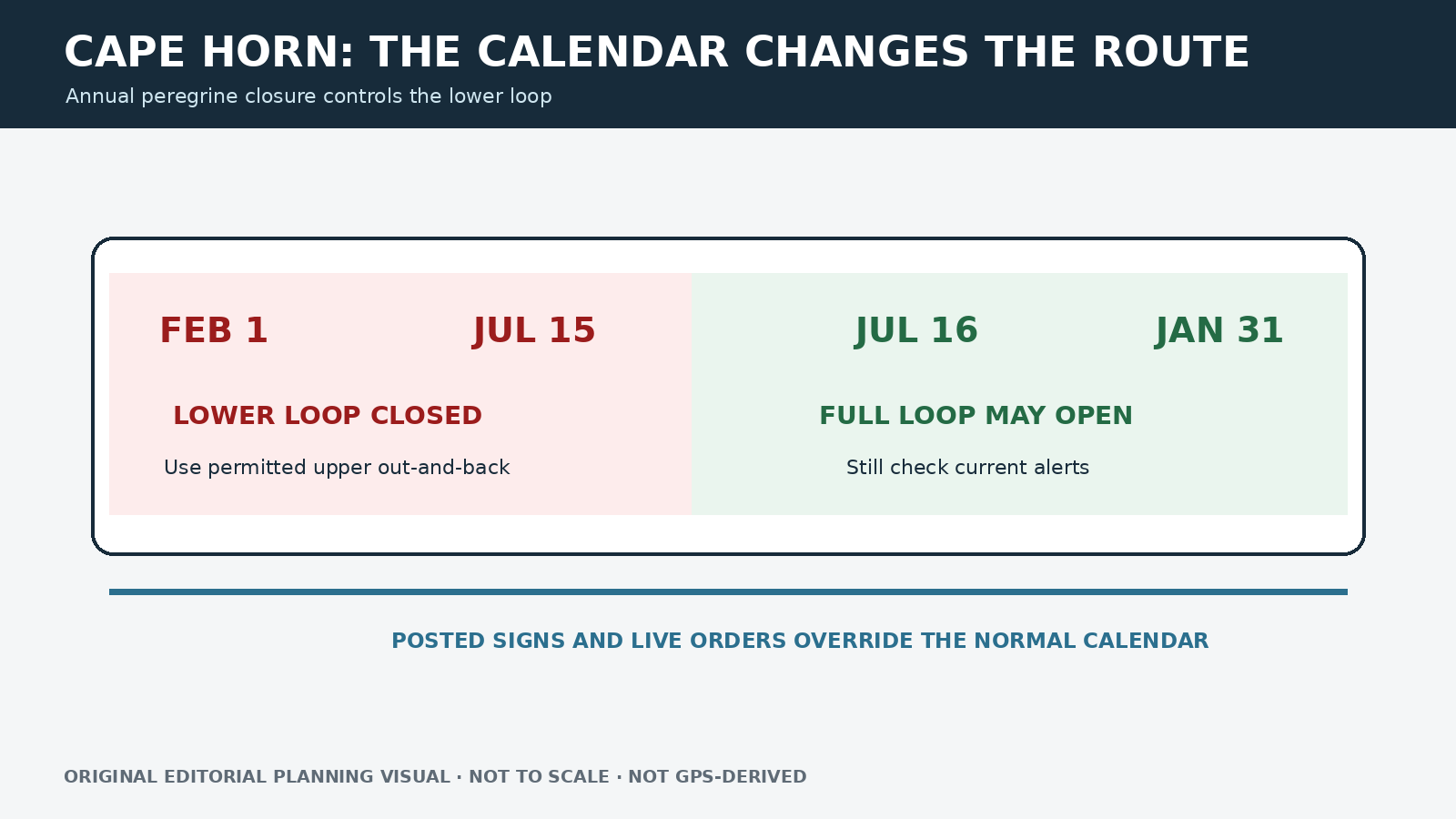
Original editorial planning graphic · not to scale · not GPS-derived
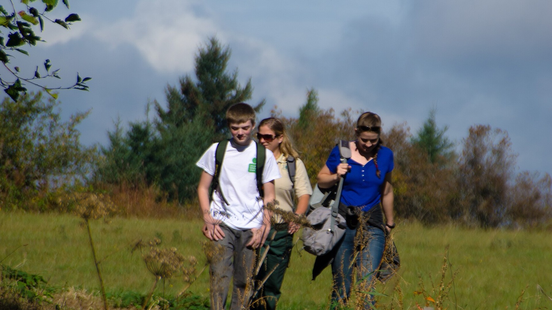
A group follows an open section of Cape Horn Trail; the legal route still changes during the annual peregrine closure. Photo: U.S. Forest Service- Pacific Northwest Region · Public domain · cropped and resized
Why different sources list different mileage
The Forest Service area description summarizes a six-mile loop, while Washington Trails Association gives a planning estimate of 7.2 miles and 1,300 feet of gain. The difference may come from route endpoints or mapping methods. Show the official summary and label the third-party estimate rather than quietly choosing whichever number looks more appealing.
February 1–July 15: upper trail only
During the closure, the upper trail provides viewpoints without entering the protected lower section. Follow posted signs and use the official trail page to confirm the permitted turnaround. Wind, rain and exposed overlooks can still make the upper route a poor choice. A legal partial hike is not automatically an easy or low-risk one.
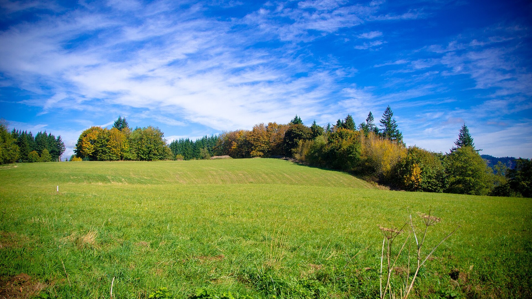
Fall color gives the open Cape Horn landscape a brighter seasonal character, but wind and exposed viewpoints remain planning factors. Photo: U.S. Forest Service- Pacific Northwest Region · Public domain · cropped and resized
July 16–January 31: the full loop may be open
From July 16 through January 31, the lower section may be available when current conditions and official status allow. Check route direction, road crossings and every junction on the latest map. Start early enough to finish in daylight; this is a day-use area, not a place to plan an improvised overnight.
Parking and weather determine whether the route fits
Use the designated trailhead parking and follow posted limits. Do not assume that a fee or pass used at another Washington destination applies here. Cape Horn is best for hikers comfortable with uneven trail, substantial mileage and open Gorge viewpoints. Strong wind, smoke, heat, wet footing or a height-sensitive group may all be good reasons to choose another plan.
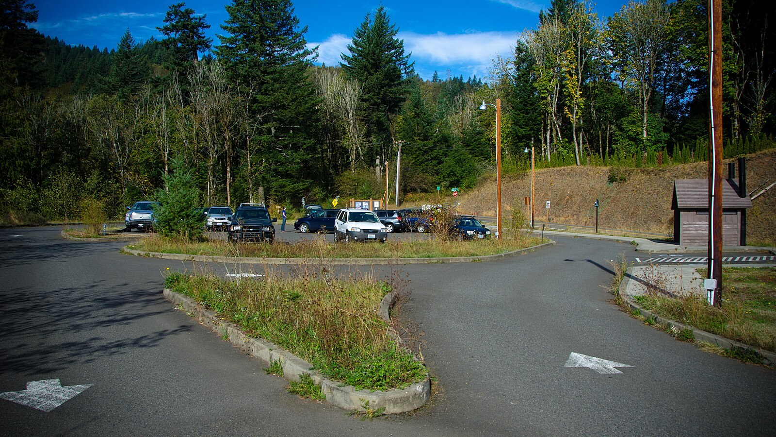
Use designated parking and verify current posted limits. Photo: U.S. Forest Service Pacific Northwest Region · Public domain · cropped and resized
Choose alternatives that respect the closure
During the nesting closure, use the upper out-and-back instead of trying to force the loop. Hamilton Mountain offers waterfall and summit options but uses the Discover Pass system. Dry Creek Falls is a forested Oregon-side route with a different parking fee. Check the official information for every backup before leaving.
Keep the seasonal closure visible in your plan
Compare the date with the closure window, then confirm the signs at the trailhead. Save the official trail page, but treat posted signs as the immediate boundary. An app may continue to show the full loop during nesting season; that line is not permission to enter. If the lower trail is closed, tell the group where the upper route will turn around. Even during the open season, check for temporary orders that may replace the normal calendar.
Cape Horn’s exposed viewpoints can feel much windier and colder than the trailhead. Turn around early when clouds lower, smoke thickens or wet trail makes footing uncertain. Carry enough water for the longer published mileage estimate. Keep children and dogs under close control around viewpoints and road crossings, subject to current rules. If the parking area is full, leave rather than using a park-and-ride shoulder or nearby private access as overflow.
Key dates and mileage
Official area description: Approximately 6-mile loop
Supplemental estimate: About 7.2 miles and 1,300 feet, depending on mapped route and source
Lower-loop closure: February 1 through July 15 every year
During closure: Use the permitted upper out-and-back only
Use: Daylight hours; confirm current area rules
Checked: August 24, 2026
Related hiking guides
Sources and last checked
Official agency pages are the authority for closures, access, fees and rules. Supplemental organizations are used only for clearly labeled planning estimates. This guide is based on published sources and does not claim a firsthand hike. Recheck all time-sensitive details on the publication date and again before travel.
Last checked: August 24, 2026. Review the page whenever an alert, fire restriction, road or gate status, fee, permit, seasonal rule, trail repair or official map changes.
Photo and graphic credits
Group walking on Cape Horn Trail-Columbia River Gorge (24828682640).jpg — U.S. Forest Service- Pacific Northwest Region, Public domain. · Fall Color along Cape Horn Trail-Columbia River Gorge (24490877053).jpg — U.S. Forest Service- Pacific Northwest Region, Public domain. · Parking at Cape Horn Trailhead-Columbia River Gorge (24499048453).jpg — U.S. Forest Service- Pacific Northwest Region, Public domain.
Functional visual: original editorial graphic created for this article; not a trail map, GPS track or measured elevation profile.