10 Best Hikes in the Columbia River Gorge
Ten classic Gorge hikes, organized by scenery, effort, exposure, and the access details that can make or break the day.
Official sources were last checked on August 25, 2026. This guide draws on current agency information rather than a firsthand trail review.
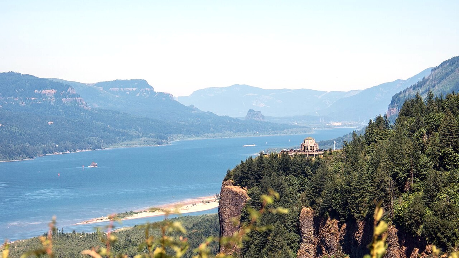
Crown Point and Vista House overlook the lush western Gorge, home to many of the region's best-known waterfalls and busiest trailheads. Photo: m01229 · CC BY-SA 2.0 · cropped, resized and lightly exposure-adjusted
TRAIL UPDATE – Fire restrictions and closures can change quickly throughout the Gorge. Several Oregon State Parks trailheads now charge day-use parking fees, and the 2026 timed-use permit for Multnomah Falls access from I-84 remains in effect through September 7. Check the trail and parking pages linked below before you leave.
Check before you go: Columbia River Gorge alerts · Columbia River Gorge passes · permits for popular Columbia Gorge sites
At a glance
|
If you're looking for… |
Try this |
|
A famous landmark |
Multnomah Falls |
|
A short waterfall hike |
Wahclella Falls |
|
A west Gorge viewpoint |
Angel's Rest |
|
A demanding spring hike |
Dog Mountain, when seasonal permit rules allow |
|
A dramatic canyon trail |
Eagle Creek, if narrow cliffside sections do not bother you |
For the latest conditions and access details, see: Columbia River Gorge alerts · Columbia River Gorge passes · permits for popular Columbia Gorge sites
How the Gorge changes as you head east
The Gorge changes noticeably from west to east. Drive time, vegetation, weather, and even the parking experience can be very different from one area to the next.
|
Area |
What it's known for |
Know before you go |
|
West Gorge |
Waterfalls and lush forest |
Crowds and small lots along the Historic Highway |
|
Cascade Locks |
Canyon trails and PCT connections |
Fees, closures, and narrow exposed trails |
|
Hood River area |
Food, lodging, and backup options |
A longer drive and frequent wind |
|
East Gorge |
Open slopes and spring wildflowers |
Heat, full sun, sensitive habitat, and seasonal closures |
For current conditions and access details, see: Columbia River Gorge alerts · Columbia River Gorge passes · permits for popular Columbia Gorge sites
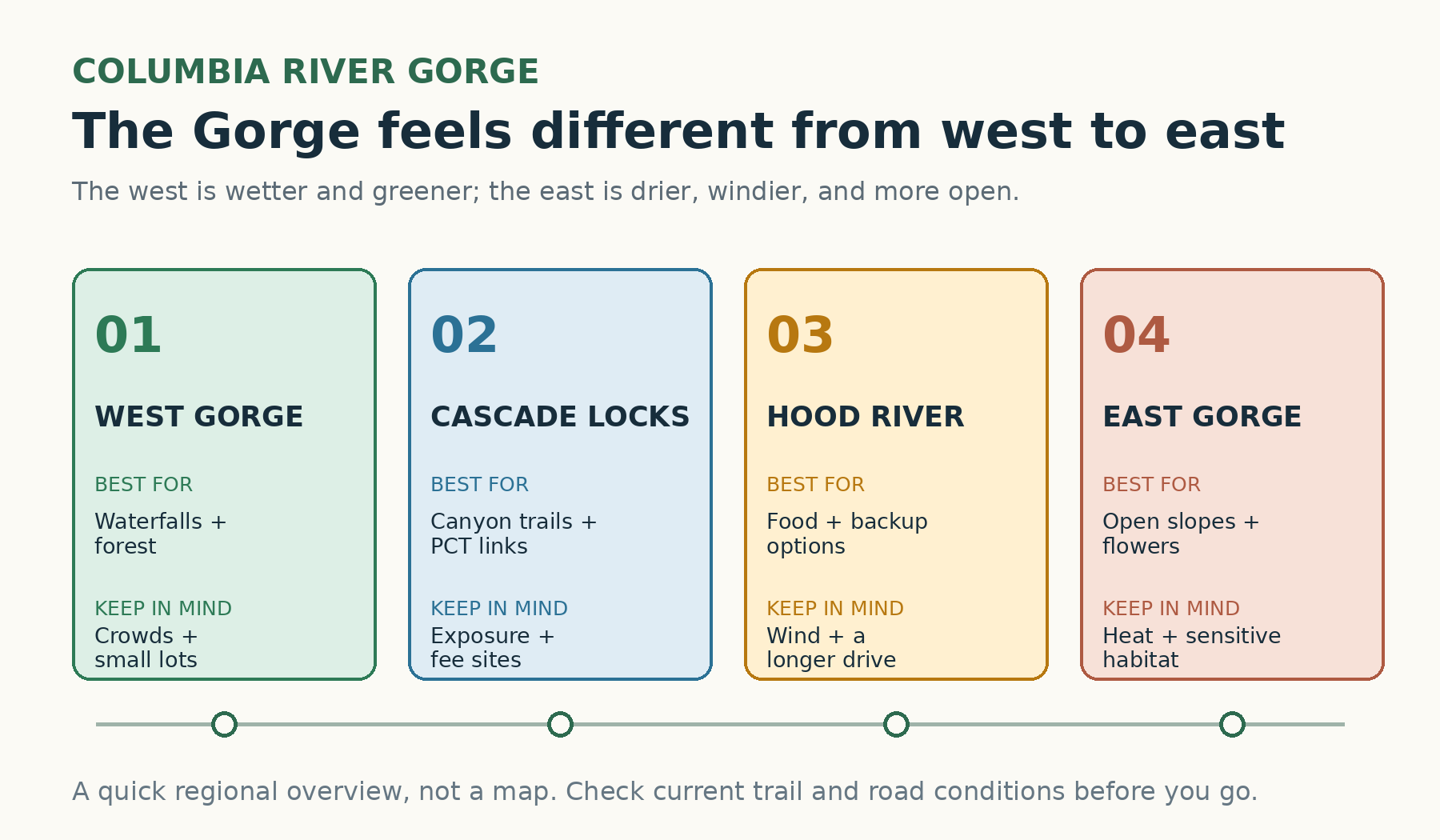
The scenery, weather, and trail experience change noticeably as you travel east through the Gorge. Original graphic by the editorial team. For comparison only; not a navigational map.
Compare the hikes
|
Trail |
Effort |
Highlights |
Know before you go |
|
Multnomah Falls |
Easy viewpoint to strenuous climb |
Famous waterfall |
Expect crowds, especially in peak season |
|
Wahclella Falls |
Moderate |
Short canyon waterfall |
Small lot; $5 fee or accepted recreation pass |
|
Angel's Rest |
Strenuous |
West-Gorge viewpoint |
Exposed bluff and small parking area |
|
Eagle Creek |
Moderate, with exposure |
Cliffside canyon scenery |
Cable sections and unprotected drop-offs |
|
Dog Mountain |
Strenuous |
Open slopes |
A long climb and seasonal spring permits |
|
Cape Horn |
Moderate to strenuous |
River views from the Washington side |
Seasonal wildlife closures may affect the loop |
|
Catherine Creek |
Easy to moderate |
Wildflowers and open terrain |
Stay on signed routes |
|
Coyote Wall |
Easy to strenuous |
A drier, shared-use trail network |
Download the map and watch for other trail users |
|
Hamilton Mountain |
Strenuous |
Waterfalls and viewpoints |
A Discover Pass may be required |
|
Latourell Falls |
Moderate |
Waterfall loop |
Storm damage can affect the full loop |
Use this table as a starting point, then check the official trail page for current conditions.
How to choose the right Gorge hike
Few places pack so much scenery into such a short drive. The west Gorge is known for waterfalls, basalt cliffs, and lush forest, while the east Gorge opens into sunnier slopes and broad river views. Conditions can be rainy in the west and windy or hot in the east on the same day.
The best route depends on the weather and the people hiking it. Waterfalls are often at their best in wetter months, while higher or more exposed trails demand extra attention to wind, ice, heat, and wildfire conditions. Parking also matters. If the designated lot is full, move on to a legal alternative instead of improvising a roadside space.
Ten standout Columbia River Gorge hikes
Multnomah Falls to the top
Multnomah Falls offers an immediate view from the plaza, plus a 2.4-mile round-trip climb to the top for hikers who want more. Crowds are part of the experience. During the 2026 peak season, private vehicles using I-84 Exit 31 need a timed-use permit between 9 a.m. and 6 p.m.; the permit does not guarantee a parking space.
Wahclella Falls
Wahclella Falls follows Tanner Creek through a narrow, rock-walled canyon to the falls. At 2.4 miles round trip, it delivers a lot of scenery without taking the whole day. A $5 day-use fee or accepted recreation pass is required.
Angel's Rest
Angel's Rest climbs steeply to an exposed bluff with sweeping Gorge views. Most route guides put the hike at about 4.8 miles round trip with roughly 1,500 feet of elevation gain. Parking fills quickly, and the cliff edges call for extra care.
Eagle Creek to Lower Punchbowl
Eagle Creek is more serious than its mileage may suggest. The spur to Lower Punchbowl begins 1.8 miles from the trailhead, but getting there involves narrow ledges, cable-assisted sections, wet rock, and steep drop-offs.
Dog Mountain loop
Dog Mountain is one of the hardest popular hikes in the Gorge. The Forest Service lists the Dog Mountain-Augspurger loop at 6.8 miles with 2,828 feet of climbing. Spring weekends may require a permit, while summer brings heat and long stretches of exposed terrain.
Cape Horn
Cape Horn is popular for open river views and seasonal wildflowers. Wildlife closures can affect parts of the loop, so use the managing agency's current map instead of relying on an old GPS track.
Catherine Creek
Catherine Creek suits hikers who want open terrain, spring wildflowers, and several route options rather than one big summit climb. Stay on marked trails to protect the area's sensitive plant communities.
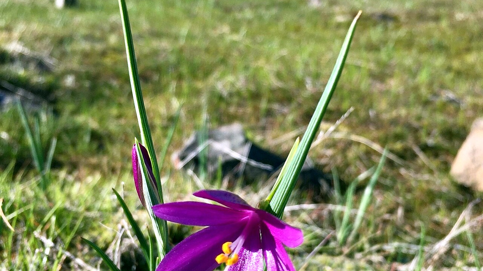
A grass widow blooms at Catherine Creek, where spring wildflowers draw hikers to the drier east Gorge. Photo: U.S. Forest Service Pacific Northwest Region · Public domain · cropped, resized and lightly exposure-adjusted
Coyote Wall
Coyote Wall has a drier, more open feel than the west Gorge, along with far-reaching river views. The network is shared with other trail users and includes many junctions, so download the current map and follow restoration signs.
Hamilton Mountain
Hamilton Mountain is a strenuous Washington-side hike with waterfalls and broad viewpoints. Because the trail starts in Beacon Rock State Park, check the park website for current trail conditions and Discover Pass requirements.
Latourell Falls loop
The Latourell loop combines a tall lower waterfall, a forest walk, and an upper falls. Check the Oregon State Parks page for the current route and any storm damage before you go.
Current trail conditions and access: Columbia River Gorge alerts · Columbia River Gorge passes · permits for popular Columbia Gorge sites
Which hikes work for different groups?
Newer hikers may feel most comfortable at Wahclella Falls, on a shorter visit to Multnomah Falls, or on a clearly marked loop at Catherine Creek. Angel's Rest and Latourell add more climbing without reaching the scale of Dog Mountain. Eagle Creek is best left to hikers who are calm and sure-footed on narrow, exposed trail; its mileage does not tell the whole story.
Families should consider steep edges, water, crowds, and a child's ability to follow directions, not just the mileage. Dog owners should check both the leash rules and the terrain. The official Eagle Creek page warns that unleashed dogs have fallen from steep sections or caused other dogs to fall.
Parking, fees, and permits
Fees and permits vary from one Gorge trailhead to the next. Eagle Creek and Wahclella each require a $5 federal day-use fee or a valid recreation pass. The Oregon State Parks page for Angel's Rest lists a day-use parking permit. Dog Mountain requires a day-use fee and, on designated spring weekends, a separate hiking permit.
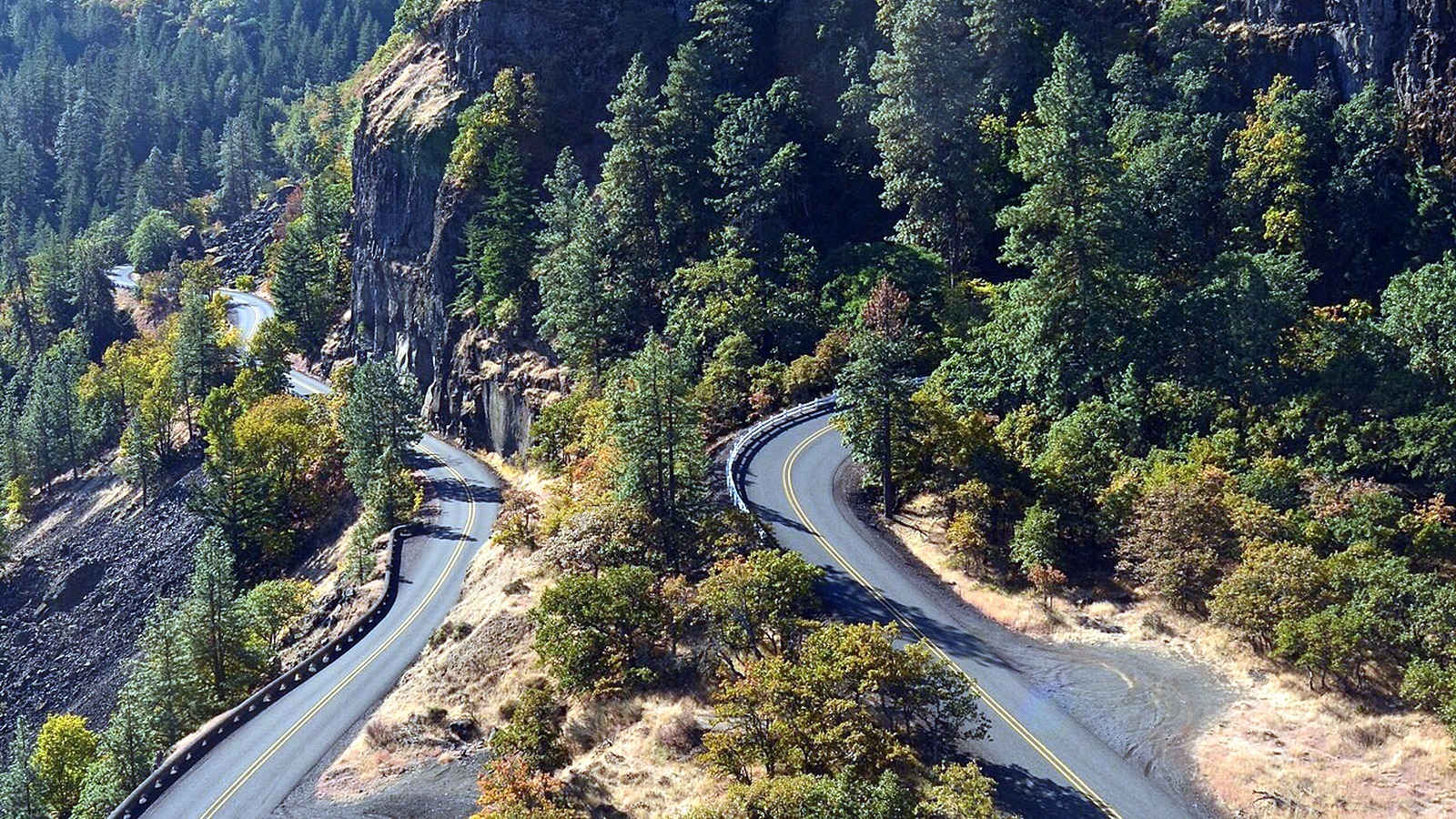
The Rowena Loops show how much the Gorge's winding roads can add to the day. Leave room for the drive as well as the hike. Photo: Joe Mabel · CC BY-SA 4.0 · cropped, resized and lightly exposure-adjusted
Multnomah Falls uses a separate timed-entry system for vehicles arriving from I-84 Exit 31 on the busiest 2026 dates. Shuttle and transit passengers do not need that permit. Check the rules for every trailhead instead of assuming that one pass works everywhere in the Gorge.
Frequently asked questions
What is a good first hike in the Gorge? Wahclella Falls is a great introduction when it is open: the trail is short, scenic, and easy to follow. Multnomah Falls is the classic landmark, but it takes more planning because of crowds and access rules.
When is waterfall season? Winter and spring often bring stronger flow, along with ice, mud, fallen trees, and storm closures. Summer trails are usually drier, but waterfalls may have less water and popular sites are often busier.
Can I rely on cell service? No. Download the official map, permit, and driving directions before entering the corridor.
More hiking guides
Sources and update notes
Trail details in this guide come from the public agencies linked below. Mileage and elevation can vary with reroutes, side trips, turnaround points, and GPS methods. Access rules, fees, and closures were last checked on August 25, 2026. Check the relevant agency page again before you go. This is an independently researched guide, not a firsthand trail review.