9 Best Waterfall Hikes in the Columbia River Gorge
From roadside viewpoints to cliffside canyon trails, these nine options cover the Gorge's best-known waterfalls and the access details that matter before you go.
Official sources were last checked on August 25, 2026. This guide draws on current agency information rather than a firsthand trail review.
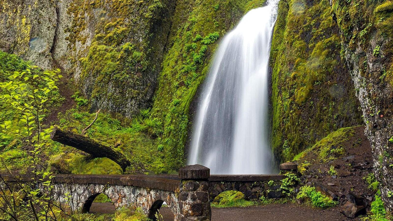
The stone path and bridge at Wahkeena Falls can stay wet from spray, even though they are only a short walk from the road. Photo: Gary Halvorson, Oregon State Archives · CC BY 4.0 · cropped, resized and lightly exposure-adjusted
TRAIL UPDATE – Fire restrictions and closures can change quickly in the Gorge. The 2026 timed-use permit for Multnomah Falls access from I-84 remains in effect through September 7, and Oregon State Parks now requires day-use parking permits at Bridal Veil and Latourell. Check each park or trail page before you leave.
Check before you go: Columbia River Gorge alerts · Multnomah Falls · Wahclella Falls Trail #436 · Eagle Creek Trailhead & Trail #440
Quick picks
|
If you're looking for… |
Try this |
|
The classic landmark |
Multnomah Falls |
|
A short canyon hike |
Wahclella Falls |
|
Several waterfalls on one trail |
Eagle Creek, if you are comfortable with narrow ledges |
|
A waterfall loop |
Latourell Falls |
|
A roadside stop with a hiking option |
Horsetail Falls, then Ponytail Falls if you want to keep hiking |
For the latest conditions and access details, see: Columbia River Gorge alerts · Multnomah Falls · Wahclella Falls Trail #436 · Eagle Creek Trailhead & Trail #440
Before you choose a waterfall hike
The most famous waterfall is not always the best choice for the day. Check these five things before you choose.
For current conditions and access details, see: Columbia River Gorge alerts · Multnomah Falls · Wahclella Falls Trail #436 · Eagle Creek Trailhead & Trail #440
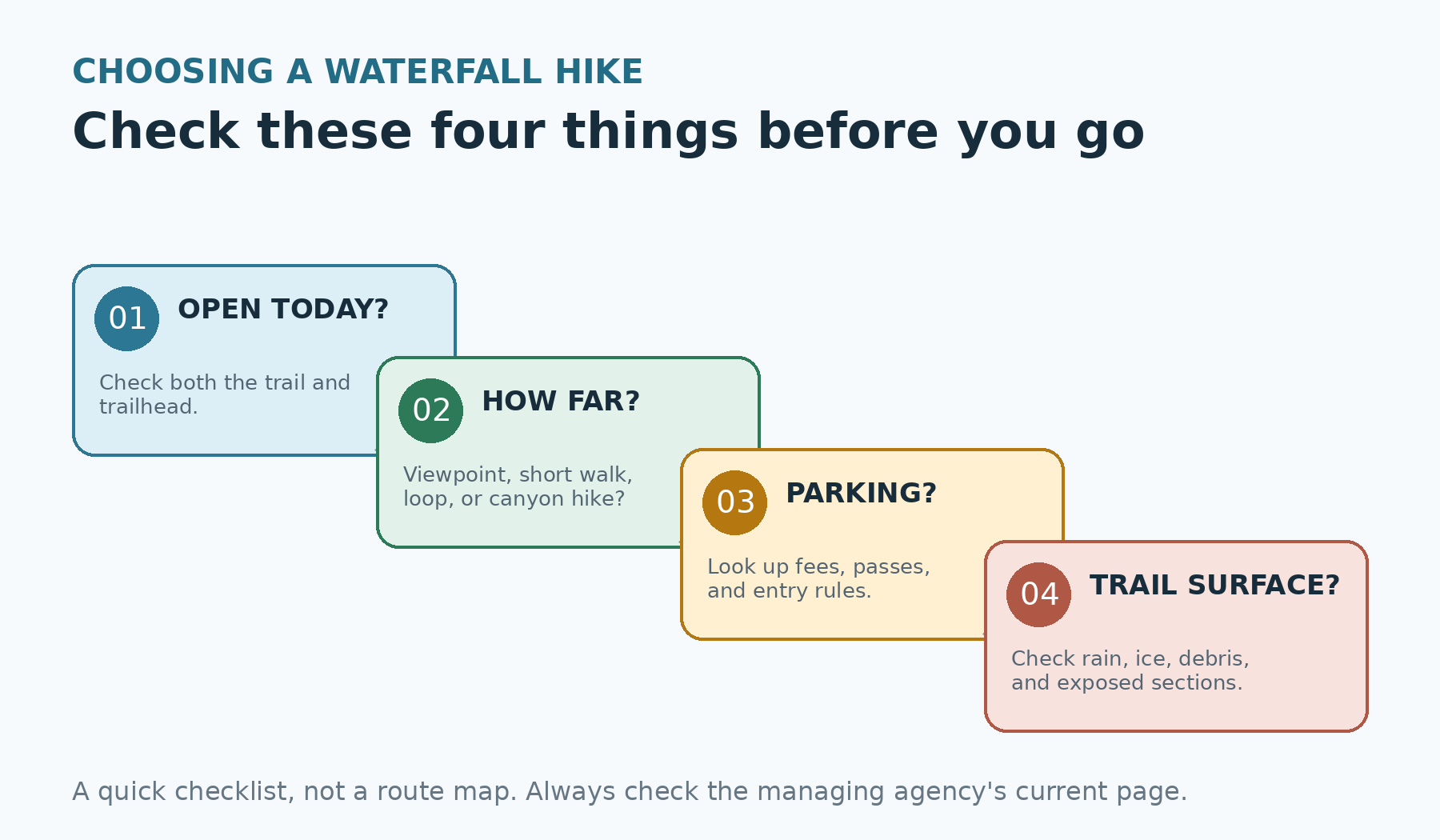
Before choosing a waterfall hike, check what is open, how far you want to walk, where you will park, and how slick the trail may be. Original graphic by the editorial team. For comparison only; not a navigational map.
Compare the waterfall hikes
|
Trail |
Effort |
Highlights |
Know before you go |
|
Multnomah Falls |
Viewpoint or 2.4-mile hike |
Famous waterfall and historic lodge |
Decide whether you are stopping at the plaza, bridge, or top |
|
Wahclella Falls |
2.4 miles |
A short canyon hike |
Wet trail and a small parking area |
|
Latourell Falls |
Mileage varies by loop |
Lower and upper falls |
Check the park map and storm-damage notices |
|
Bridal Veil Falls |
Short |
A short state-park walk |
Expect stairs and slick surfaces |
|
Lower Punchbowl |
About 3.6 miles or more |
A shorter Eagle Creek destination |
Narrow ledges make it harder than the mileage suggests |
|
Upper Eagle Creek |
Long |
Multiple falls |
Pick a turnaround before you start |
|
Dry Creek Falls |
Moderate |
Forest waterfall reached from the PCT |
Check connecting trails and current landslide closures |
|
Coopey Falls |
Part of the Angel's Rest climb |
A waterfall feature on a viewpoint hike |
Best paired with the Angel's Rest viewpoint hike |
|
Horsetail / Ponytail |
Roadside view or short climb |
Roadside falls with an optional trail extension |
Wet footing, steep edges, and changing loop conditions |
Use this table as a starting point, then check the official trail page for current conditions.
Choose between a quick view and a longer hike
Some Gorge waterfalls are visible within minutes of the parking area; others require miles of hiking. At Multnomah Falls, you can stop at the plaza or climb all the way to the top. Wahclella takes more trail time but remains a manageable half-day outing. Eagle Creek offers several waterfall turnarounds, but its narrow ledges make it a much more demanding choice.
The list includes quick viewpoints, shorter walks, loops, and longer canyon hikes. Mileage depends on your turnaround point and any current reroutes, so check the agency map before you go.
The 9 Waterfall Hikes
Multnomah Falls
Multnomah Falls is the Gorge's best-known waterfall. You can stop at the lower viewpoint, continue to Benson Bridge, or hike the 2.4-mile round trip to the top. During the 2026 permit season, private vehicles arriving from I-84 Exit 31 need a timed-use permit; the permit does not guarantee parking.
Wahclella Falls
Wahclella Falls follows Tanner Creek into a narrow, rock-walled canyon. The Forest Service lists the hike at 2.4 miles round trip, with a $5 day-use fee or valid recreation pass.
Latourell Falls loop
Latourell is a good choice when you want more than a roadside waterfall stop. The loop links the tall lower falls with forest and the upper falls. Check the current Oregon State Parks map and any storm-damage notices before committing to the full loop.
Bridal Veil Falls
Bridal Veil offers a short walk to the falls plus a separate overlook trail. It works well for a lighter outing, though the stairs and wet surfaces can still be slippery.
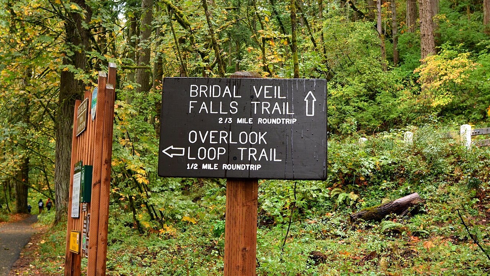
The sign at Bridal Veil points to two separate walks: the short trail to the falls and the overlook loop. Photo: Joe Mabel · CC BY-SA 4.0 · cropped, resized and lightly exposure-adjusted
Eagle Creek to Lower Punchbowl
The Lower Punchbowl spur begins 1.8 miles along Eagle Creek Trail #440. Even this shorter destination involves exposed ledges, cable-assisted sections, and basalt that becomes slick when wet.
Eagle Creek farther up-canyon
Punch Bowl, Loowit, and Tunnel Falls sit progressively farther up the canyon. Plan each destination as its own hike, choose a firm turnaround time, and confirm that every section is open. Do not turn a Lower Punchbowl outing into a much longer day on impulse.
Dry Creek Falls
Dry Creek Falls is commonly reached from the Pacific Crest Trail near Cascade Locks and can be a moderate alternative to the busier waterfall corridor. Confirm the exact access route before leaving. A January 2026 landslide closure affects the Historic Columbia River Highway State Trail between Eagle Creek and Cascade Locks, so do not improvise a connection through a closed section.
Coopey Falls via Angel's Rest
The Angel's Rest trail passes above Coopey Falls on the way to the viewpoint. This route makes sense when the Gorge panorama is the main goal and the waterfall is a feature along the way, rather than the destination itself.
Horsetail Falls and Ponytail Falls
Horsetail Falls is visible from the roadside. If conditions are good and the group is comfortable with wet footing and steep edges, continue up Trail #438 toward Ponytail Falls. Decide how far you plan to go before starting, and check the longer loop separately; access to the lower falls does not mean every connecting trail is open.
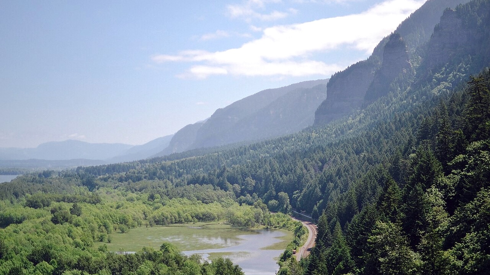
The trail above Horsetail Falls opens to broad Gorge views, but exposed sections still call for careful footing and good judgment. Photo: Anna Del Savio · CC BY-SA 4.0 · cropped, resized and lightly exposure-adjusted
Current trail conditions and access: Columbia River Gorge alerts · Multnomah Falls · Wahclella Falls Trail #436 · Eagle Creek Trailhead & Trail #440
When to go
Winter and spring usually bring stronger flow, along with shorter daylight, ice, debris, and storm closures. On cold mornings, spray can freeze on shaded sections of trail. Summer usually means drier footing, but also more crowds, lower water flow, fire restrictions, and hotter climbs.
Higher flow is not always better. After heavy rain, streams can rise quickly, slopes may shed rocks or trees, and creek crossings can become unsafe. Check agency alerts, and turn around if conditions no longer match what you expected.
Staying safe around waterfalls
Wear shoes that grip well on wet rock, and pack a dry layer in a waterproof bag. Download the official map, choose a turnaround time, and keep children and dogs away from unprotected edges and fast-moving water. Do not climb on logs, enter closed side trails, or stand beneath unstable overhangs for a photo.
Dogs must be leashed at Eagle Creek, but a leash does not make the narrow ledges safe. At Multnomah Falls, the timed-use permit covers entry from I-84; it does not reserve a parking space. Never wait in a travel lane or create your own roadside parking spot.
Frequently asked questions
Which waterfall hike is easiest? A visit to the lower viewpoint at Multnomah Falls or one of the short state-park waterfall walks usually involves less walking and climbing than a full loop. Check the official page for accessibility details and current surface conditions.
Which waterfall hike is best for a half day? Wahclella Falls is one of the simplest choices when the trail is open and parking is available.
Can I see several waterfalls in one day? Yes. The simplest approach is to make separate short stops with legal parking rather than trying to improvise a trail connection. Leave plenty of time for driving and finding a space.
More hiking guides
Sources and update notes
Trail details in this guide come from the public agencies linked below. Mileage and elevation can vary with reroutes, side trips, turnaround points, and GPS methods. Access rules, fees, and closures were last checked on August 25, 2026. Check the relevant agency page again before you go. This is an independently researched guide, not a firsthand trail review.