How to Hike the Columbia River Gorge Without a Car
A practical guide to buses, seasonal shuttles, waterfall stops and bus-and-bike trips from Portland.
Research-based planning guide · Official information checked August 27, 2026 · Verify changing rules before travel
Service alert: schedules and stops can change with congestion, road work and season. Confirm the return trip on the operator’s official page before starting the hike.
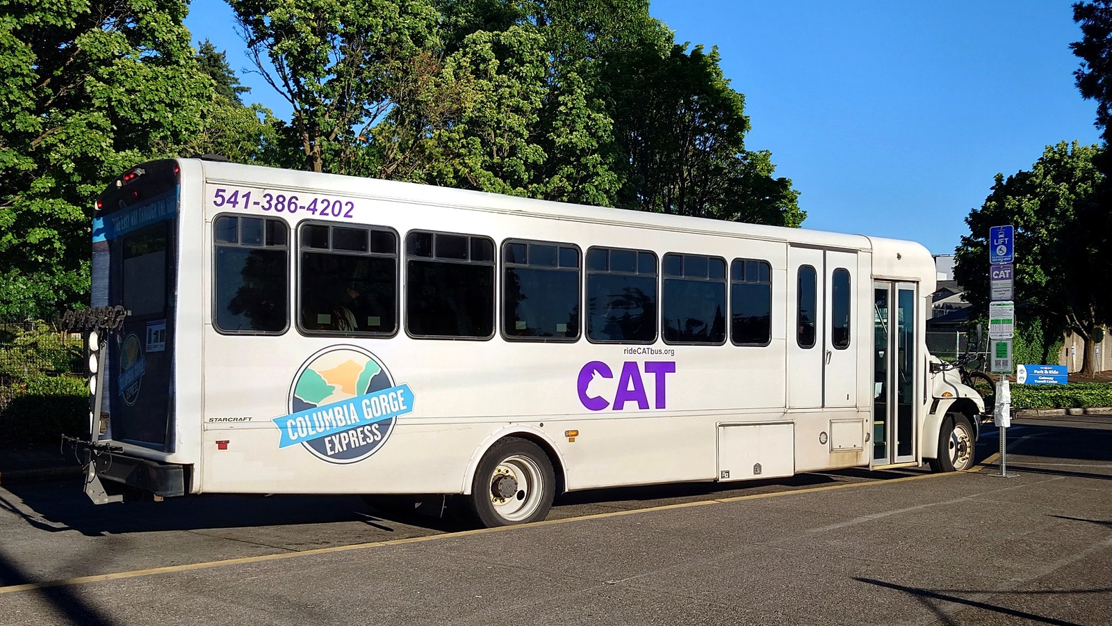
The Columbia Gorge Express connects Portland’s Gateway Transit Center with Multnomah Falls, Cascade Locks and Hood River seven days a week. Photo: Ac530 · CC BY 4.0
Which Gorge trips work best without a car
A car-free hiking day works best when transit stops at the trailhead, leaves you within a short walk, or connects to a bike route that suits your experience. Multnomah Falls is the simplest option from Portland. Cascade Locks and Hood River are good choices for town-based outings, while the seasonal Dog Mountain shuttle provides direct trailhead access on selected spring dates.
Other waterfall-corridor trailheads require a different service. The public Columbia Gorge Express does not stop at every waterfall. A private hop-on, hop-off trolley serves several Historic Columbia River Highway destinations, and a low-cost private shuttle offers direct Multnomah Falls trips from Troutdale during its operating season. The best option depends on the exact stop, not simply on whether the hike is in the Gorge.
A reliable itinerary starts with the ride home. Choose the departure you plan to take, identify a backup, and then work backward to set your turnaround time. This is safer than planning the entire hike first and hoping the return schedule works afterward.
Which bus or shuttle goes where?
|
Service |
Best for |
What to know |
|
Columbia Gorge Express |
Gateway Transit Center, Multnomah Falls, Cascade Locks and Hood River |
Does not stop at every trailhead; congestion can delay service or force a rare Multnomah Falls bypass. |
|
Waterfall Trolley |
Latourell, Bridal Veil, Angel's Rest, Wahkeena, Multnomah, Triple Falls, Horsetail and Ainsworth |
Private seasonal service with its own fare and roughly hourly stop pattern. |
|
Dog Mountain Shuttle |
Dog Mountain on designated 2026 spring permit days |
Seasonal only; riders connect through Cascade Locks and must follow the operating calendar. |
|
Sasquatch Multnomah Express |
Direct Multnomah Falls trip from the Columbia Gorge Premium Outlets in Troutdale |
Private seasonal service; useful for the falls, not a corridor-wide trailhead network. |
|
Bus plus bicycle |
Reaching a trailhead or state-trail section beyond a fixed bus stop |
Confirm bike-rack space, road conditions, weather and the return schedule. |
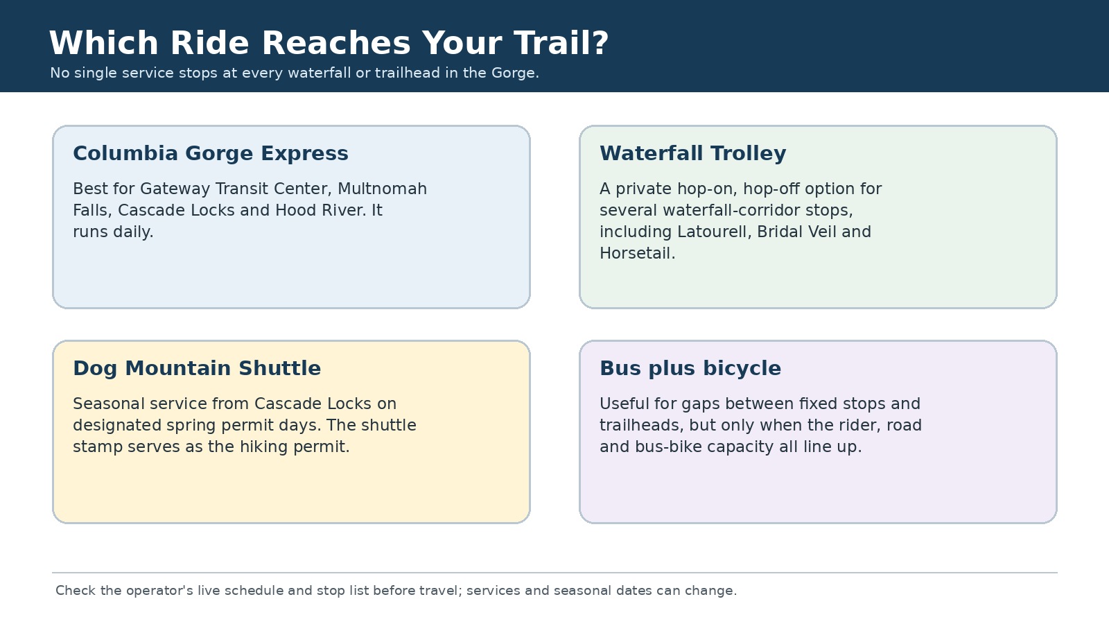
The most useful service depends on the exact trailhead. Original editorial graphic; verify the operator’s stop list.
Getting from the stop to the trailhead
A route name on a transit map tells only part of the story. What matters is where the bus or shuttle actually stops and whether the rest of the trip involves a short walk, a seasonal transfer or a bicycle ride. A stop in a nearby town does not necessarily mean the trailhead is safe to reach on foot.
|
Destination |
Transit connection |
From the stop to the trailhead |
|
Multnomah Falls |
Columbia Gorge Express or a private direct shuttle |
The stop serves the visitor area; this is the simplest car-free Gorge destination. |
|
Cascade Locks |
Columbia Gorge Express |
Good for visiting town or making a transfer, but not every nearby trailhead has a direct stop. |
|
Dog Mountain |
Express to Cascade Locks, then the seasonal Dog Mountain shuttle |
The shuttle reaches the trailhead only on its scheduled permit-season days. |
|
Eagle Creek area |
Express to Cascade Locks, then roughly 3 miles by bicycle |
Best for experienced riders who have checked the road, state-trail conditions and bike-rack availability. |
|
Bonneville / Wahclella area |
Express to Cascade Locks, then roughly 6 miles by bicycle |
Before taking this longer bike connection, check the wind, traffic, construction and return schedule. |
|
Latourell, Bridal Veil, Wahkeena or Horsetail |
Waterfall Trolley on its operating schedule |
The trolley stops at these destinations, but hourly service is easier to pair with shorter hikes. |
Columbia Gorge Express: the main public bus from Portland
Columbia Area Transit operates the Columbia Gorge Express seven days a week between Portland and Hood River. The core stops are Gateway Transit Center, Multnomah Falls, Cascade Locks and Hood River; selected trips also serve Troutdale. The 2026 one-way fare is $10. CAT also lists an annual Gorge Transit Pass at $40 for adults and $20 for youth, which can make sense for repeat trips.
This route works best for a direct trip to Multnomah Falls, a day in Cascade Locks or an outing that begins or ends in Hood River. It is not a general trailhead shuttle. The regular express does not serve every trailhead near Eagle Creek, Wahclella Falls, Angel's Rest, Latourell Falls or Horsetail Falls, so check the actual stop instead of judging the distance from a map.
Road work and visitor congestion can delay the bus. CAT notes that lane closures may affect service from March 1 through fall 2026. In rare cases, a driver may bypass the Multnomah Falls stop when congestion makes it unsafe to enter; passengers already on board may continue to Cascade Locks and wait for the next bus. Build extra time into the day in case that happens.
Getting to Gateway Transit Center
Gateway Transit Center is the Portland connection point for the Columbia Gorge Express. TriMet's MAX Blue, Green and Red lines serve Gateway, making it reachable from downtown, several eastside neighborhoods and Portland International Airport without a car. Allow time to move between the MAX platform and the bus pickup area, especially on the first trip of the day.
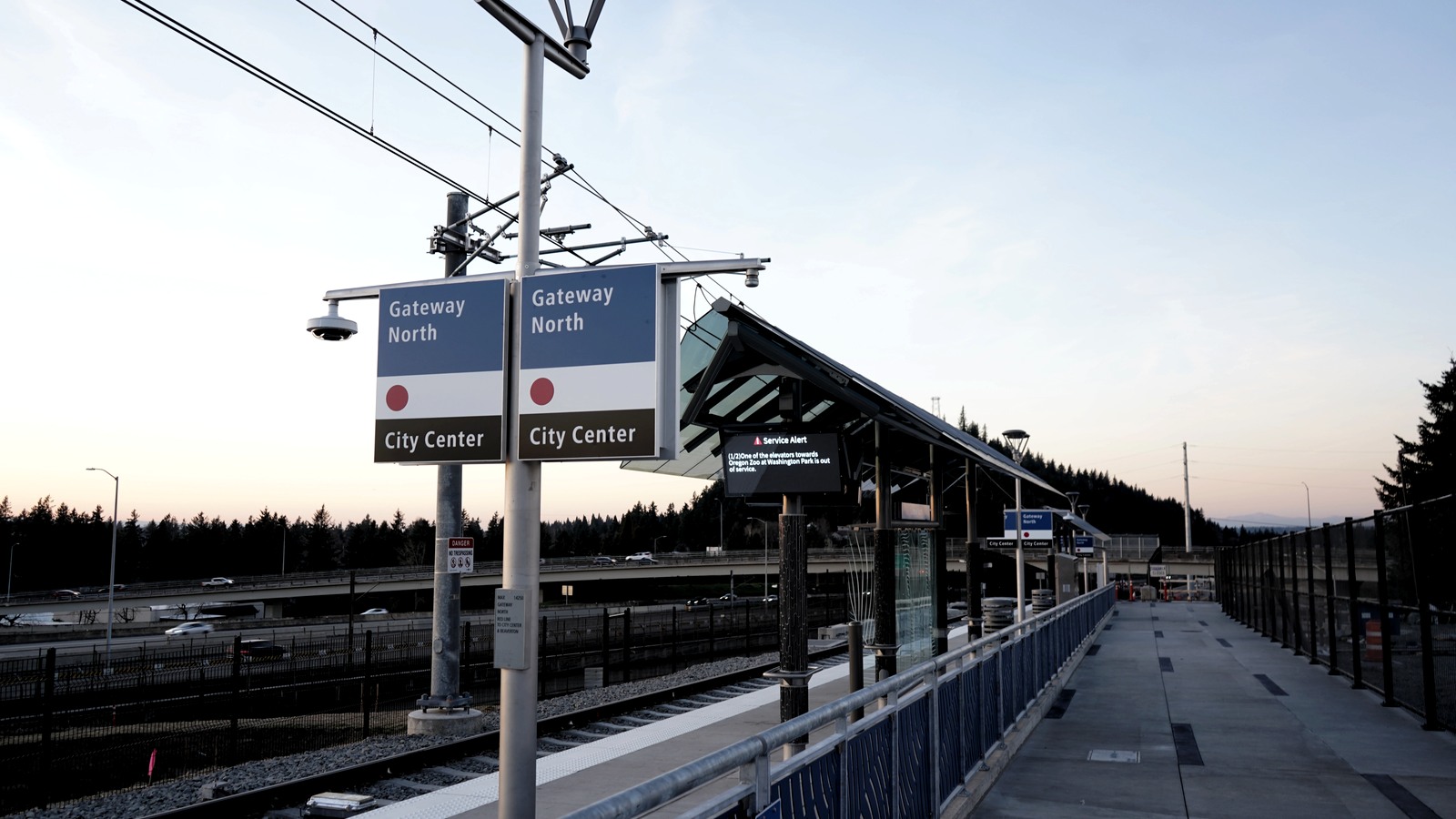
MAX Blue, Green and Red lines connect to Gateway Transit Center, where riders transfer to the Columbia Gorge Express. Photo: Tuckertwo · CC0 1.0
Waterfall Trolley: more stops along the Historic Highway
The Waterfall Trolley is a private hop-on, hop-off service rather than part of the CAT network. Its 2026 route begins at free parking in Corbett and lists ten stops: Corbett, Crown Point, Latourell Falls, Bridal Veil Falls, Angel's Rest, Wahkeena Falls, Multnomah Falls, Triple Falls, Horsetail Falls and Ainsworth State Park. Trolleys generally arrive about once an hour.
The listed 2026 fare is $39 for adults, $20 for ages 6–12 and free for children 5 and younger. The trolley is especially useful when the destination is one of the waterfall-corridor stops that the Columbia Gorge Express does not serve. Riders do not need the Multnomah Falls I-84 timed-entry permit, because they are not entering that parking area in a private vehicle.
A hop-on, hop-off ticket still requires careful timing. Before leaving a stop, check the next pickup and how many later trips remain. Short waterfall walks are easier to fit into an hourly schedule than a long hike with an uncertain finish time.
Taking the Dog Mountain shuttle during permit season
CAT's Dog Mountain shuttle is scheduled for weekends from April 11 through June 7, 2026, plus Memorial Day. The shuttle runs from Cascade Locks about every 30 minutes and is free in 2026. Hikers coming from Portland can take the Columbia Gorge Express to Cascade Locks and transfer.
Shuttle riders receive a stamp that serves as the required seasonal hiking permit, so they do not need a separate vehicle reservation or a space in the small trailhead lot. The shuttle makes access easier, but the hike itself remains steep and exposed to changing spring weather.
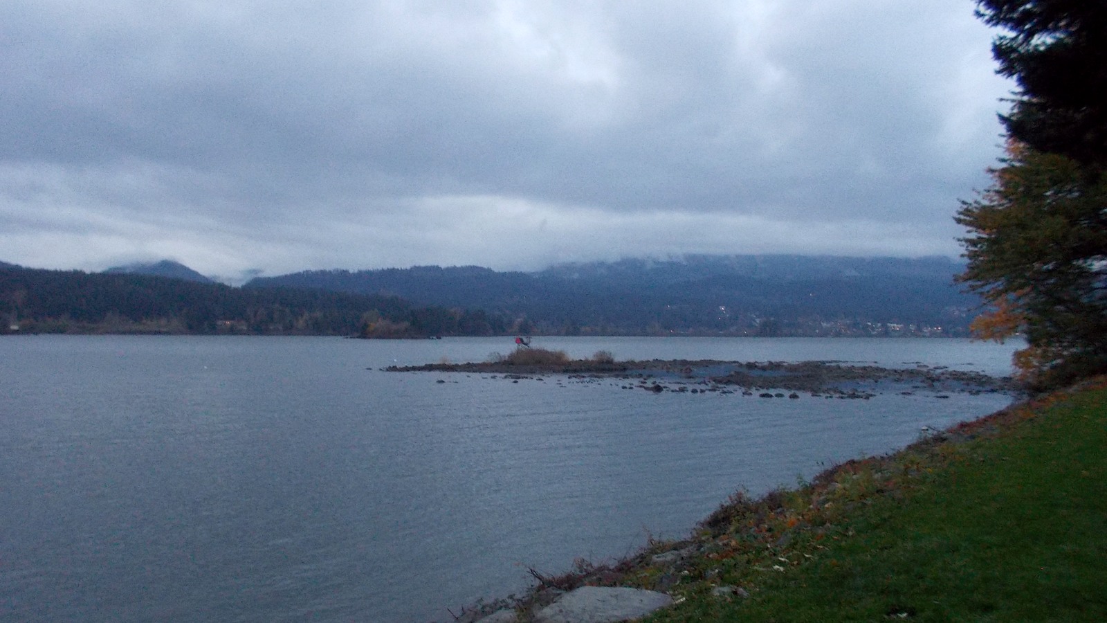
Cascade Locks is both a Columbia Gorge Express stop and the transfer point for the seasonal Dog Mountain shuttle. Photo: Kingofthedead · CC BY-SA 4.0
A direct shuttle from Troutdale to Multnomah Falls
The Sasquatch Multnomah Express is another private option. For the 2026 summer season, it lists $5 round-trip rides from the Columbia Gorge Premium Outlets in Troutdale, where parking is free. Service is scheduled from May 23 through September 7, with outbound buses roughly hourly from 9 a.m. to 4 p.m. and a final return after 6 p.m.
This is a straightforward way to see Multnomah Falls, but it is not designed for a long corridor hike or a trip ending at a different trailhead. Check the operator's current timetable before relying on any listed departure, especially near the beginning or end of the season.
When it makes sense to bring a bike
Bringing a bicycle can bridge some of the gaps between fixed bus stops and nearby trailheads. The Gorge transit network highlights connections from Cascade Locks toward Eagle Creek, Bonneville and the Wahclella Falls area, along with car-free sections of the Historic Columbia River Highway State Trail. These links make several shorter rides and hikes possible from a town stop.
This option works only if every part of the connection is suitable. Confirm that the bus carries bicycles, that rack space is available and that your bike fits the carrier. Check the elevation, traffic exposure, construction and wind as well. A short distance on the map may include an uncomfortable shoulder, and a full bike rack can delay the return trip.
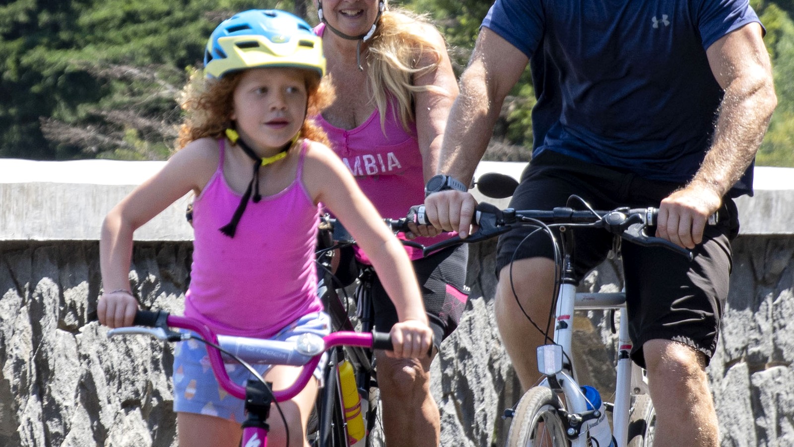
Bus-and-bike trips can extend the reach of fixed transit stops, but bicycle capacity and the safety of the road connection need to be checked in advance. Cropped to landscape. Photo: Oregon Department of Transportation · CC BY 2.0
Consider both the hike and the ride
A short walk can still be complicated when it relies on a bike rack, a roadside stop or the final seasonal shuttle. Dog Mountain presents the opposite case: the shuttle goes directly to the trailhead, but the hike is still strenuous. Make sure both the trail and transportation plan suit your group.
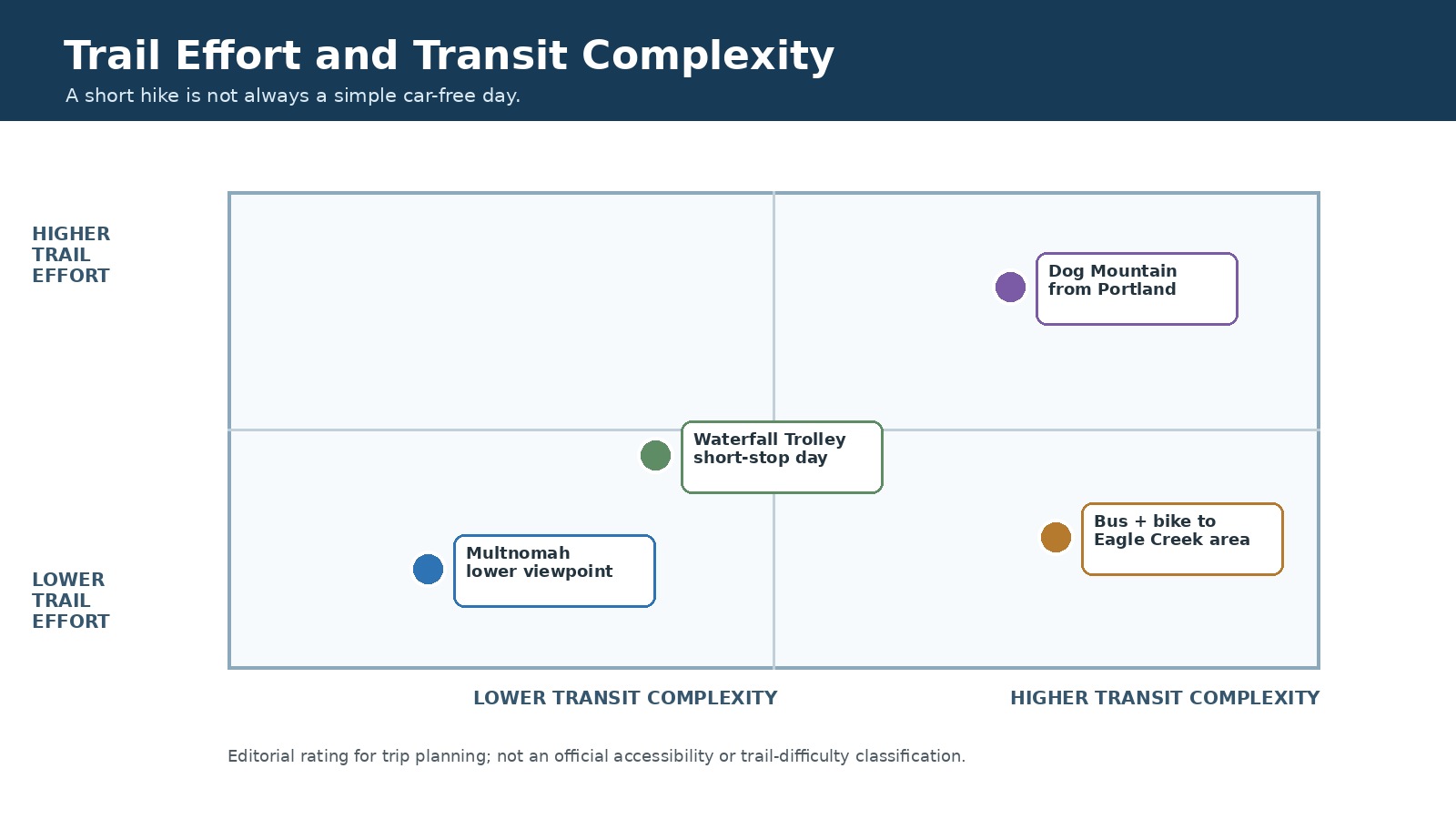
These ratings compare the complexity of the trip, not official trail difficulty or accessibility. Original editorial graphic.
Three car-free day trips from Portland
Multnomah Falls from Portland
Take MAX to Gateway Transit Center, then ride the Columbia Gorge Express to Multnomah Falls. Staying near the lower viewpoint gives you the most schedule flexibility. If you plan to continue to Benson Bridge or the top of the falls, set a turnaround time based on your intended bus and leave at least one later departure as a backup.
Waterfall stops from Corbett
Use the Waterfall Trolley when the day centers on Latourell, Bridal Veil, Wahkeena, Horsetail or another listed stop. Pair one longer walk with one nearby quick stop rather than trying to collect every waterfall. Confirm the last trolley and where you will reboard before beginning the hike.
Dog Mountain from Portland
On an operating day, ride the Columbia Gorge Express to Cascade Locks and transfer to the Dog Mountain shuttle. Allow enough time for the steep hike and both return connections. If your itinerary depends on both the final shuttle and the final Portland-bound bus, there is no room for delays, so plan to return earlier.
Plan your ride home before you start hiking
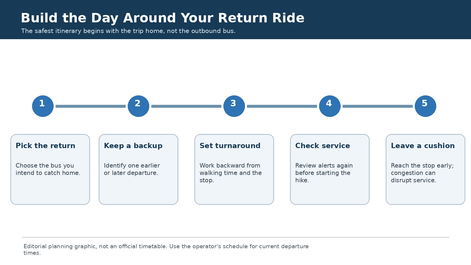
A good car-free itinerary leaves at least one later departure as a backup. Original editorial graphic; not an official timetable.
Save the current timetable or take a screenshot before entering an area with limited cell service. Note the stop name, the correct side of the road and any transfer point. Arrive before the scheduled departure time. If the hike runs late, turn around sooner and skip an optional viewpoint rather than risk missing your ride home.
How much flexibility does your return plan have?
|
Return flexibility |
Schedule |
Best approach |
|
Flexible |
Several later departures remain and no seasonal transfer is required. |
A small delay is manageable, but you should still arrive at the stop early. |
|
Limited flexibility |
Only one practical backup departure remains or the trip includes one timed transfer. |
Set a firm turnaround and check service again before leaving the stop area. |
|
Little or no flexibility |
The day depends on the final shuttle, final bus or two final connections. |
Choose an earlier return or a simpler destination instead. |
What can go wrong and how to adjust
Accessibility, children and group travel
Contact the operator before travel if you need a wheelchair space, assistance boarding or confirmation about mobility devices. For families, count transfers and waiting time as part of the day; a short walk with a predictable return may be more enjoyable than a longer route built around the final service. Larger groups should confirm capacity and avoid assuming everyone, every stroller or every bicycle will fit on the same vehicle.
Frequently asked questions
Can I reach every Gorge waterfall on the Columbia Gorge Express?
No. The regular express serves a small set of major stops. Use the Waterfall Trolley or another verified connection for several Historic Highway trailheads.
Do I need a Multnomah Falls timed-entry permit when I arrive by bus?
No. The permit applies to private-vehicle entry at the I-84 parking area during the stated season and hours.
How much is the Columbia Gorge Express in 2026?
CAT lists a $10 one-way fare. Check the fare page before travel because prices and products can change.
Does the Dog Mountain shuttle include the seasonal permit?
Yes. On operating days, riders receive a stamp that serves as the seasonal hiking permit.
Should I use the last bus as my planned return?
Plan to take an earlier departure and leave yourself a backup. A delay, a slower hike or a missed stop could otherwise leave you without a practical way home.
Official sources for current schedules and fares
Routes, fares and schedules can change. Use the official links below to confirm the time-sensitive details shortly before your trip.